Strange Maps
A special series by Frank Jacobs.
Frank has been writing about strange maps since 2006, published a book on the subject in 2009 and joined Big Think in 2010. Readers send in new material daily, and he keeps bumping in to cartography that is delightfully obscure, amazingly beautiful, shockingly partisan, and more. "Each map tells a story, but the stories told by your standard atlas for school or reference are limited and literal: they show only the most practical side of the world, its geography and its political divisions. Strange Maps aims to collect and comment on maps that do everything but that - maps that show the world from a different angle."
featured


All Stories
At 8.511.965 km², Brazil is the 5th largest country on earth, the larger ones being Russia, Canada, the US and China (in that order). The country conjures up mostly images […]
I was alerted to these maps by a Turkish gentleman, who posts them on his website. They are a reaction to the map of the Middle East, re-drawn as it […]
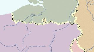
Belgium sits astride one of the main cultural fault lines of Europe, consisting roughly of a northern half that speaks Dutch and is oriented towards the ‘anglosphere’ and a southern […]
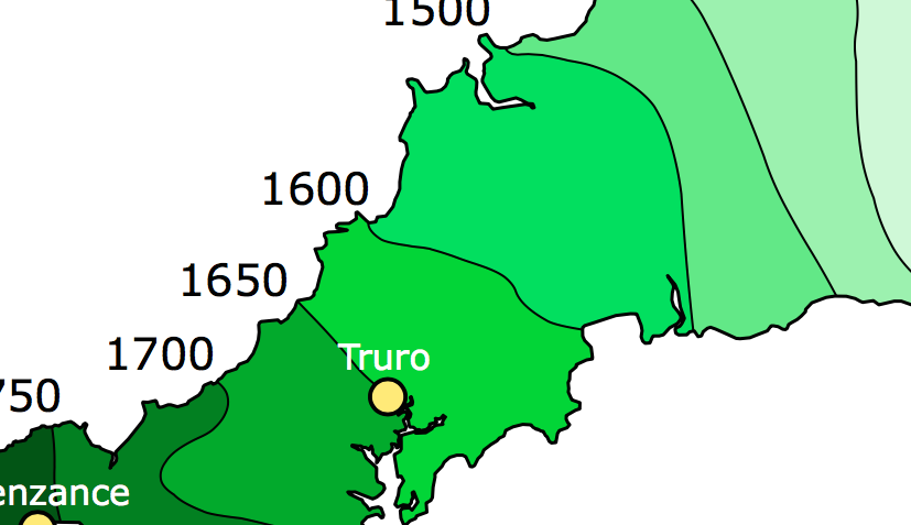
Cornwall is the southwesternmost county of England. As with other ‘extremities’ of the British Isles, it was one of the refuges of the original (partially romanized) Celtic inhabitants, fleeing before […]
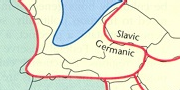
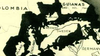
An interesting look at the religions and language groups that are elements of division (and union) in Europe. The mapmaker wanted to make a point by indicating three ‘core areas’ […]
The British tried their hand at subduing Afghanistan in the 19th Century, when the Empire was at the top of its game. Their troops were massacred (with one man left […]
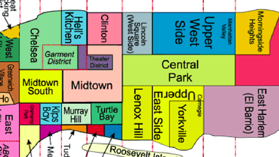
Any and every American city is built up out of Avenues and Streets, most of them numbered. A much nicer way to describe a city is by mapping its neighbourhoods. […]
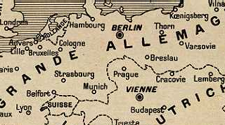
What would Europe have looked like, had Imperial Germany won World War One? This image is taken off a French magazine at the start of the war, painting an exaggerated […]
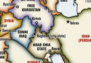
The Americans are sinking into a quagmire of their own making in Iraq, but still fantasise about re-drawing the map of the whole Middle East more to their liking. One […]
The Albanians are descendants of the Illyrians, an ancient Balkan people who preceded the Slavic populations surrounding their native territories. They presently have an independent nation – Albania, in their […]
So you’re a map nerd and you think you know about every cartographic anomaly in the world, from the bizarre Belgian enclave of Baarle-Hertog in the south of the Netherlands […]
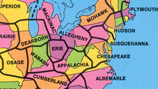
In the 1970s, geography professor G. Etzel Pearcy proposed redrawing the borders of the US states, reducing them from 50 to 38.
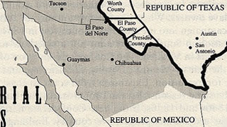
Texas is a special state within the US – not only the biggest of the contiguous 48 states, but also culturally distinct. Furthermore, it was at one time an independent […]
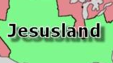
The meme that captured the 2004 post-election blues.

Apart from being a past sponsor of international terrorism and the West’s new best friend in North Africa, Libyan leader Muammar Gadaffi is also a crackpot dictator with the bizarrest […]