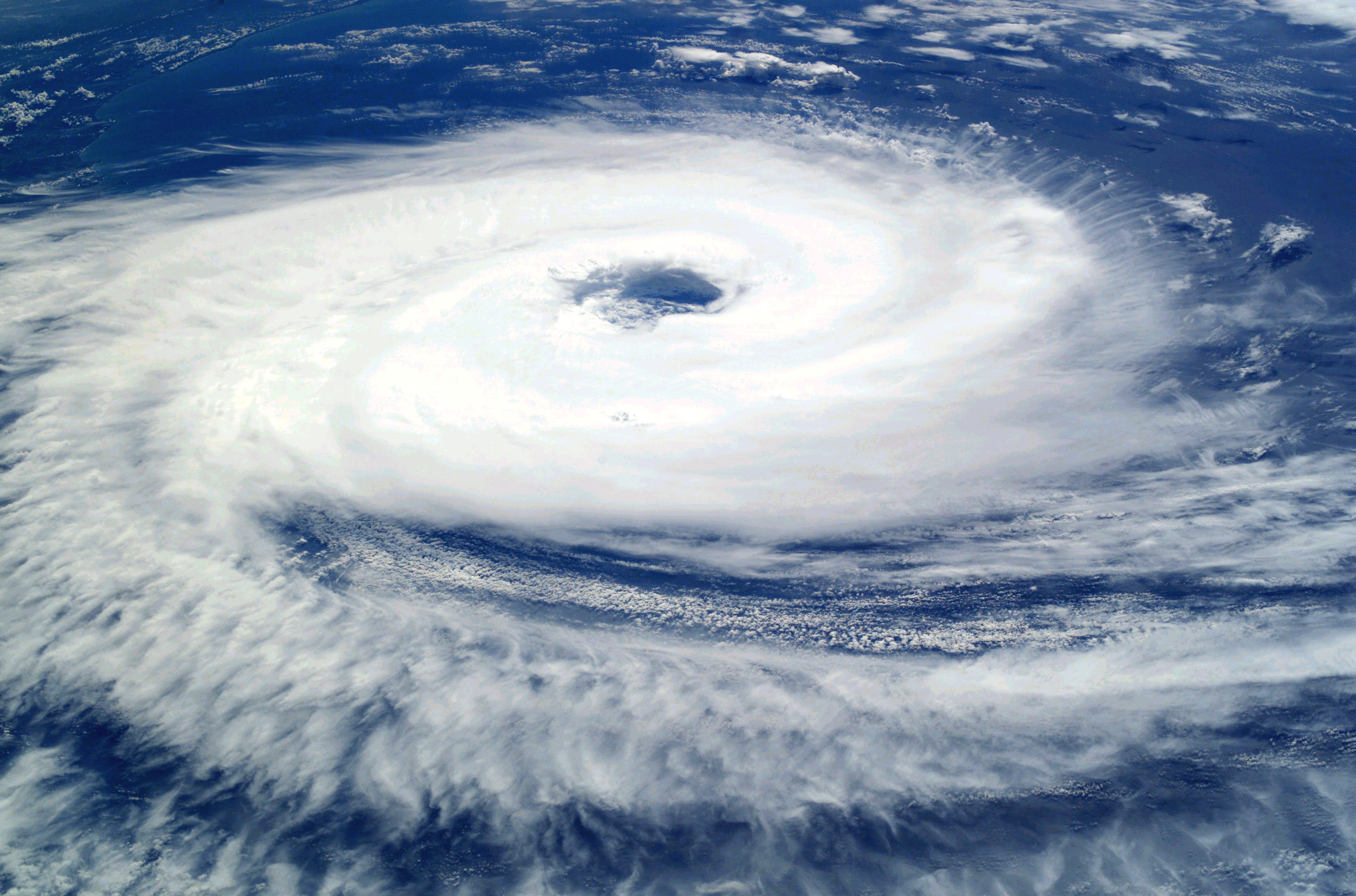
Hurricanes never cross the equator. Here’s why.

Here are four things about hurricanes that you may not know.
One: They’re the local name of a global phenomenon. Large tropical storms in the western part of the Pacific Ocean are called typhoons. In the Indian Ocean, they’re called cyclones. In the North Atlantic or the eastern part of the Pacific, they’re hurricanes. The term “tropical cyclones” is often used as a catch-all term. Occasionally, a storm will “cross over” and get two labels, as happened in 2006 with Ioke. Arising in the Central North Pacific as hurricane Ioke, the storm wandered into the Northwest Pacific, where it was known as typhoon Ioke.
Two: There will never be a hurricane Israel. Hurricanes are named alphabetically, alternating male and female names, from lists that rotate every six years. The first Atlantic hurricanes of 2025 will be Andrea, Barry, Chantal, and Dexter, while the first Pacific ones will be Alvin, Barbara, Cosme, and Dalila. Similar systems are in place for cyclones and typhoons. Names of particularly heavy storms are taken out of rotation, as are names deemed politically or culturally sensitive. So, for one reason or another, there will never again be Atlantic hurricanes called Floyd (last used in 1999), Katrina (2005), or Sandy (2012); nor Pacific hurricanes called Adolph (2001), Israel (designated for 2001 but never used), or Isis (2004).
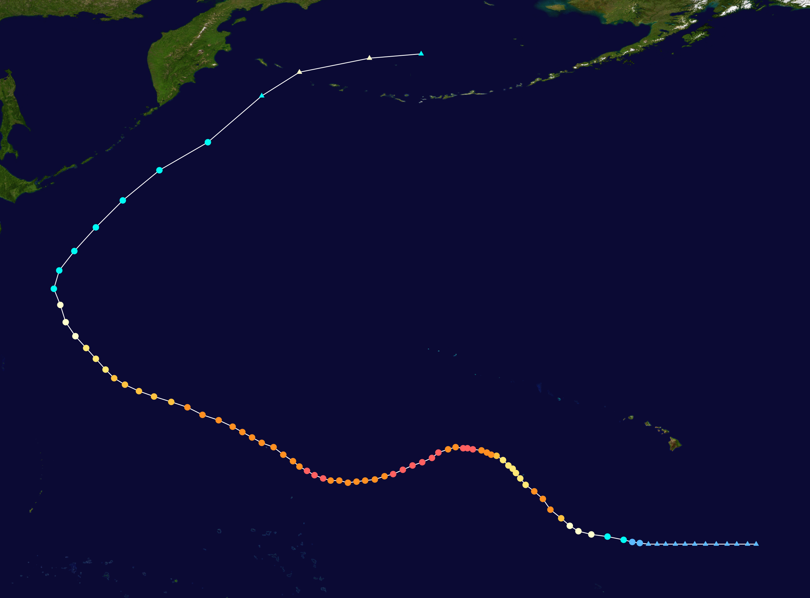
Three: There are no hurricanes (or whatever you want to call them) in the Southeast Pacific or the South Atlantic. Almost 90% of large tropical storms form within latitudes 20° north or south of the equator, where the waters are at least 27°C (81°F), warm enough for storms of these strengths to form. The Southeast Pacific and South Atlantic are the only two tropical ocean basins where this isn’t the case. This is due to the Peru Current and the Benguela Current, which carry cool water from higher latitudes toward the equator into these two basins respectively. A rare exception was hurricane Catarina, which made landfall in Brazil in 2004, as can be seen on the main map, which shows all tropical cyclone tracks from 1985 to 2005. Catarina is the only hurricane-strength storm on record in the South Atlantic. Some meteorologists have attributed its formation to global warming, which means there may be more in the future.
And four: As shown on the map above, hurricanes, typhoons, and cyclones never cross the equator, and usually don’t form within five degrees latitude of that line. This is because of the Coriolis force, which is the effect that the rotation of the Earth has on the direction of sufficiently large masses of water or air: in the Northern Hemisphere, they will rotate counterclockwise, and clockwise in the Southern Hemisphere. The Coriolis force is zero at the equator and weakest nearer the line, which is why cyclic storms don’t form in a 400-mile-wide strip on either side of this divider. And since storms would have to perform the physically impossible feat of changing direction as they cross over from one hemisphere to the other, they would in all probability simply lose their momentum and end up as a massive volume of hot air. We don’t really know, because it hasn’t happened yet — in 2001, a cyclone over Indonesia came closest yet, skirting the equator at 150 km, less than 100 miles.
Strange Maps #1246
Got a strange map? Let me know at [email protected].
Follow Strange Maps on X and Facebook.
